PATA History Pages
Map of PLSD + Residential Construction
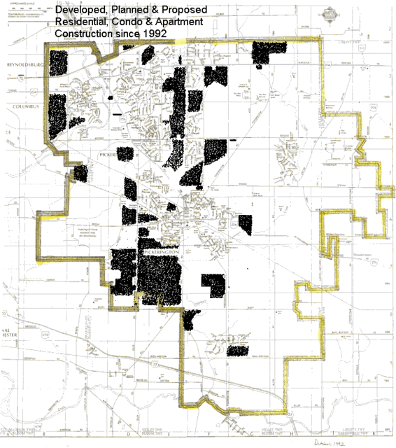
Map indicates updated housing within the PLSD - July-August New
The shaded portion of this map indicates the residential construction that has been built, is approved, or is in the process of approvals.
The area centrally located on the western boundaries of our school district is Metro Parks “Pickerington Ponds” State Natural Preserve.
As you can see – we are “filling” in our geography in a westerly to easterly direction and utilizing our vital transportation corridors, limited 2.2 million gallon per day Diley Well aquifer and Hill Road Wastewater Treatment facilities with endless subdivisions.

- Advertise Here!
-
Promote Your Business or Product for $10/mo

For just $10/mo you can promote your business or product directly to nearby residents. Buy 12 months and save 50%!
